Map of 367 Student’s Path over 2 weeks
A study into how mapping paths via GPS can be used as a Space Planning Tool
Working with members from the University of Waterloo’s Student Success Office, Secretariat, Office of Research Ethics, Office of the Provost of Student and Info Systems and Technology, I developed and deployed a custom-built mobile application for iOS and Android that allowed students to record their faculty, expected year of graduation, favourite colour, and a contact information, and then the app would run silently in the background of their smartphones, logging their location via GPS while they were on campus for a period of 2 weeks.
Working closely with the project team, we were able to register 367 students to participate (surpassing our goal of 300, or 1% of the 30,000 students of the school) and logged over 380,000 GPS points. Below are some of the maps that results from this study. Above is a video animation of the results.
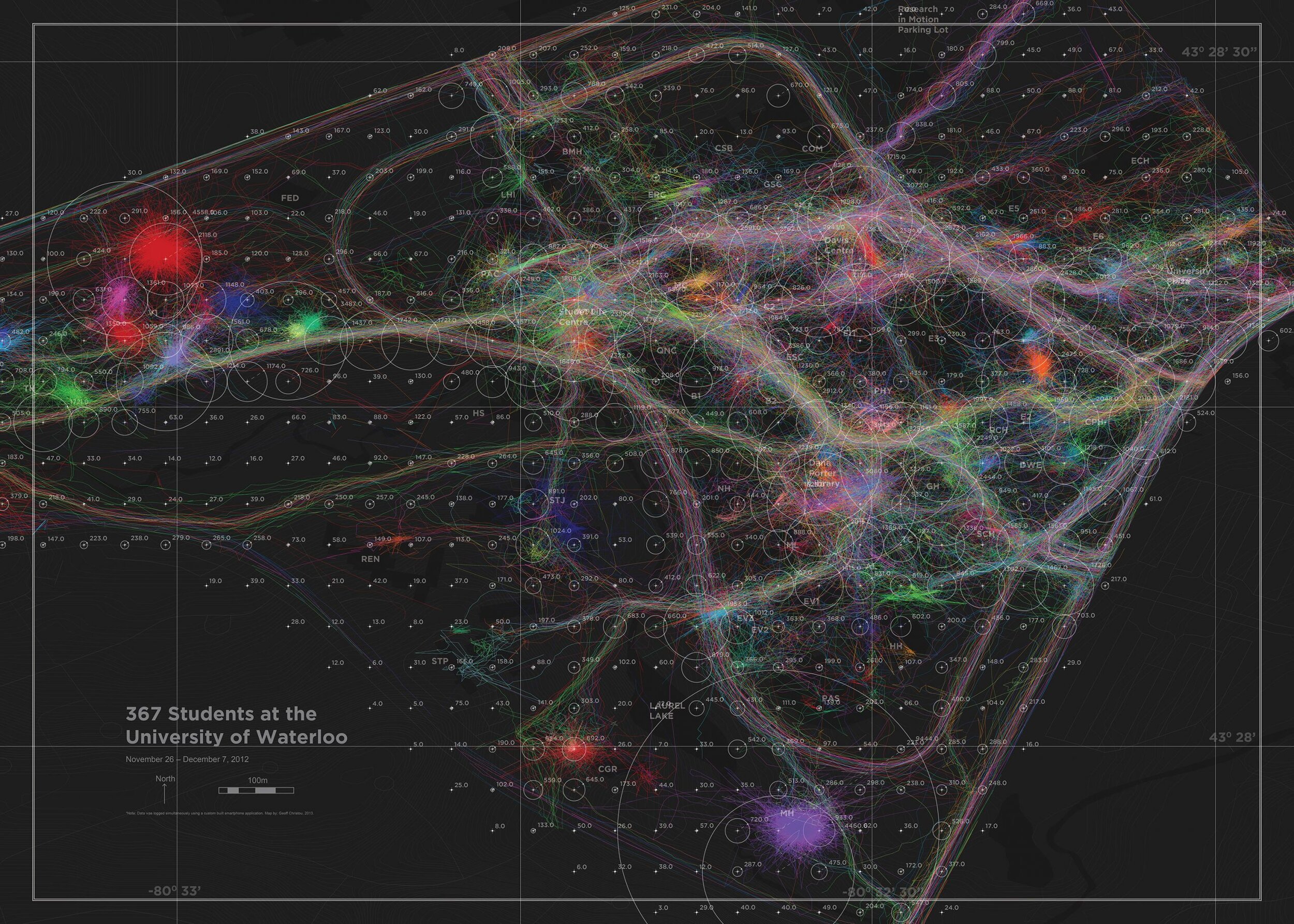
The data collected on the students’ worldlines shows that the primary orientation of pedestrian traffic on campus is east-west, and that there are currently two major arteries. This east-west connection demonstrates the importance of the city of Kitchener-Waterloo in the lives of students, more so than is currently acknowledged in the 2009 uWaterloo masterplan.

Another discrepancy between the masterplan and the reality of how students use campus, is that what is called the Transit Gateway in the masterplan is actually one of the most significant connections between the university and the city. This space currently is among the poorest, ugliest, and least pedestrian friendly on campus and is almost completely ignored by the masterplan. Any investment in this area would improve the quality of students experience and directly address an area completely overlooked by both the masterplan and the university.
Learn more at Ariadne's Thread.